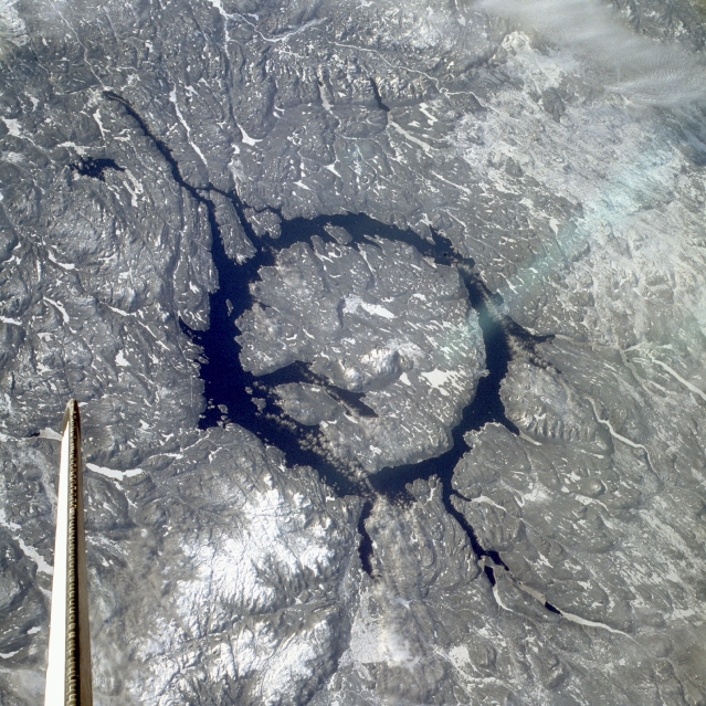
 Photo Credit: STS-9 Crew, NASA
 The Manicouagan Impact Crater in north-eastern Quebec (also known as "the eye of Quebec") was created around 200 million years ago when a 5 km diameter asteroid hit the Earth. It is one of the most interesting geographical features of the province I grew up in. The impact created land features that have filled in with water and resulted in an annular lake. The island in the center is called Rene-Levasseur Island and the highest peak is called Mount Babel. The picture above was taken by Space Shuttle Columbia in 1983 and you can see its tail fin at the lower left.
The lake is often referred to as the giant battery of Quebec because it is the source of water for several hydroelectric projects. The lake water levels are typically much lower in the winter because of high electrical demands, and the resulting elevated outflow needed to run the turbines. Water levels then recover or recharge in off-peak periods, hence the battery reference.
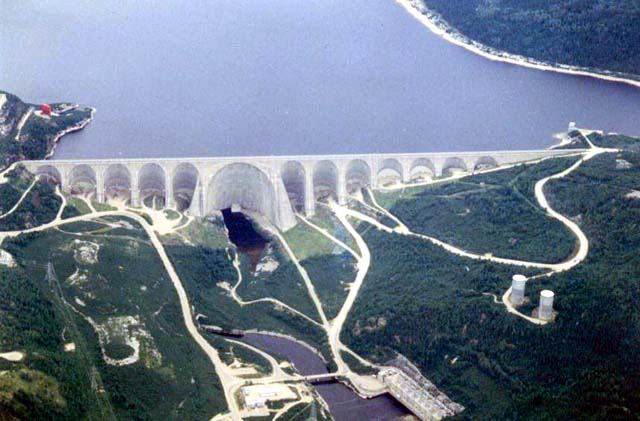 Manicouagan Dam
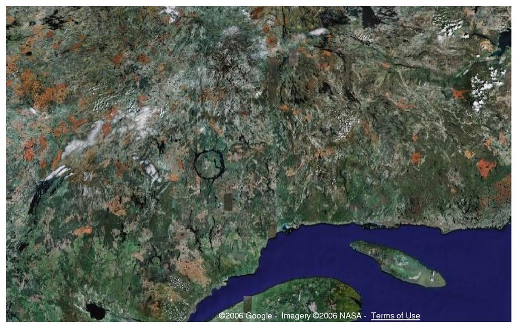
I grew up in the Lac-St-Jean area that is located about 300 kilometres south-west of the Manicouagan crater. The photo below shows Lac-St-Jean quite well at the bottom left. Apparently, it is possible to kayak or canoe around the Manicouagan annular lake and the scenery is quite spectacular. ET and I have been talking about learning how to kayak in the near future. Perhaps someday we will take a trip around the Manicouagan reservoir.
No comments:
Post a Comment